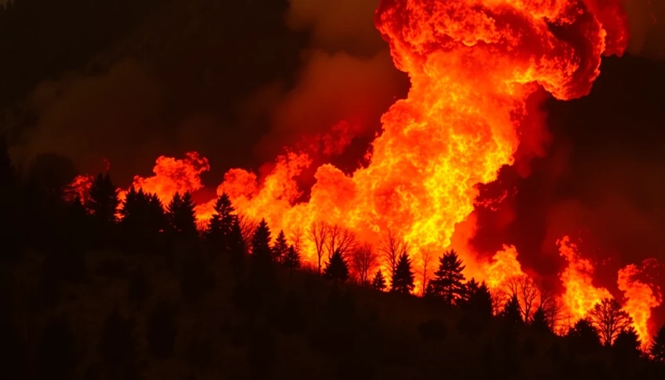
As the frequency and intensity of wildfires continue to escalate across various regions, the pressing need for robust predictive models has captured the attention of risk modelers globally. In light of relentless climate change and the increasing vulnerability of ecosystems, experts are mobilizing to enhance tools that can better forecast wildfire occurrences, thereby minimizing devastating impacts on communities and environments.
The traditional methods used for wildfire prediction have historically relied on a combination of meteorological and vegetation data, but these approaches have proven insufficient amid shifting climate patterns. As a result, modelers are now shifting toward integrating advanced technologies such as artificial intelligence and machine learning into their forecasting methodologies. These innovations could potentially revolutionize the way we anticipate wildfire events, providing timely warnings that help in resource allocation and emergency management strategies.
One prominent research initiative is focusing on the use of high-resolution satellite imagery to gather real-time data on land surface temperatures, moisture levels, and vegetation health. This comprehensive data can enhance the accuracy of predictive models, allowing for deeper insights into which regions are at a higher risk of ignition. Collaborations between researchers and satellite companies have become increasingly pivotal in this regard, emphasizing a multidisciplinary approach to tackling the complexities of wildfire behavior.
Another area of emphasis is the understanding of human factors and their role in wildfires. A substantial portion of wildfires can be attributed to human activity, whether through outdoor recreational activities or urban sprawl into fire-prone areas. Enhanced modeling that incorporates socio-economic data can significantly improve risk assessments by identifying high-risk locations and times when human activities may coincide with extreme weather conditions. This holistic approach to wildfire prediction is expected to yield more effective prevention strategies.
Despite the advancements, challenges remain. The sheer unpredictability of natural events, such as lightning strikes and sudden shifts in wind patterns, continues to complicate efforts for creating foolproof predictive models. Furthermore, the urgency of the current climate crisis necessitates that these models evolve rapidly to keep pace with changing environmental parameters.
In an interconnected world, the implications of improved wildfire prediction extend beyond local communities; they resonate on a global scale, influencing air quality, public health, and even insurance markets. Policymakers and corporations are increasingly calling for reliable forecasting tools to make informed decisions that can protect lives and economic assets. With investments flowing into research, the hope is that these endeavors will lead to tangible improvements in wildfire management and mitigation tactics.
As the scientific community persists in its quest for knowledge, it is clear that harnessing the power of technology alongside traditional methods is a promising frontier in battling the wildfire crisis. The race against time continues, but with the efforts of dedicated experts pushing boundaries, there is optimism that the future of wildfire prediction holds the potential to safeguard both people and the planet.
#WildfirePrediction #ClimateChange #MachineLearning #AI #RiskManagement #SatelliteImagery #WildfireResearch #FireSafety #EnvironmentalScience #CommunityPreparedness
Author: Peter Collins